So for the last running location before I start outline training strategies and tips (not the last overall) I would like to introduce a more complex and complicated run that includes the town of Poughkeepsie. This run will include the Mid Hudson Bridge and the roads leading up to this area. If you are afraid or fearsome of heights I would not recommend partaking in this run because the walking lane is directly next to the edge of Hudson River. So from an advisory position because I've run with people who are terrified of heights don't chance it because looking down may be a really bad decision.
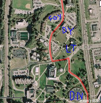
Like always starting from Mccann head out towards the south gate and this time make a left south of route 9. You are going to travel down the road until you reach the first exit off of Route 9 (Its really close and if you stay on the left its nearly impossible to pass). Head uphill towards a small walking/driving bridge which will transport you across the railroad beneath. You will now be on North Water Road and continue heading down this road past the lower train station entrance and continue until you reach the first traffic light. At this traffic light make a quick left up the road continued by a quick right onto Rinaldi Blvd. Proceed down Rinaldi for two blocks and at the second block make a left onto Gerald Dr. At this point you will continue up Gerald and on the left side of the road there will be an entrance for walkers/runners to enter onto the bridge. For visual purposes Ill provide a close up of the entrance so reader's can see where it is located. You have arrived at the bridge now its up to personal preference how far you are willing to go across the bridge. Across and back the entire bridge is approximately a little less than a mile and a half making the entire Mid Hudson Bridge run about 4.5 miles. Like all other runs follow the same route back to campus and you will have finished the Mid Hudson Bridge run. As usual I will post the a breakdown of the run in visual format below this post.
I used some letters to indicate roads and the entrance to the bridge to make it a bit more clear. G= Gerald St. Ent= Entrance the Mid Hudson Bridge B=small crossing bridge. Also I did not give the satellite version of certain parts of this run because I thought it would be easier to see the actual names of the roads you were running on since I described them in the post. That concludes the Mid Hudson Bridge run, next week I will outline a training plan with tips, recommendations for runs, and begin posting some healthy meal plans conclusive to runners.
Thursday, October 21, 2010
Monday, October 18, 2010
Quiet Cove and other news
Welcome back from a bit of hiatus from posting as I have been busy with midterm papers and tests for all of last week. Today I am going to describe a run encompassing Quiet Cove which is located north on route nine about a 1/2 mile past the North Gate. This run is extremely straight forward an totals just under 3 1/2 miles if you do the entire run. Once again we are starting at the Mccann Center and we are going to head out on Route Nine from the South Gate. Next, and the longest step of the run will consist of you going north on nine past campus eventually to the entrance of the little park area referred to as Quiet Cove. The place is almost impossible to miss because it has a rather large sign outside that reads "Quiet Cove." Turn left into the park and follow the road all the way down the hill and back up towards the entrance. If these directions seem really vague you are essentially doing a loop around the park. Once you've completed the loop head directly back to campus the same way that you arrived at Quiet Cove. Alittle hint about this place it has a rather large hill towards the end so make sure to save up enough energy for this difficult hill. Also there are trails in the back so for any interested in expanding on your run check them out.
Another few quick notes I woulf like to address in terms of the direction of this blog for this week and the upcoming weeks. I will probably give one more post about a place to run before I start designing training plans and tips for interested people. The reason I have not started so yet is because I wanted to outline a few places to run before I jumped into a complete gameplan and training regiment. I will continue to post different places each week so you vary the location and intensity of your runs. Like last post I will include the visual breakdown of the run so you can look and a study the run before you embark on it.
This last one is just a close up of the entire park because it isnt that clear on the map.
Wednesday, October 6, 2010
The Campus Mile
So in today's post I will outline one of the most basic runs someone can paretake in on the Marist campus. The run is referred to as the "campus mile" because it entails mostly the entire campus (or at least the freshman sophomore side). This run is very simple and easy to explain. First, head out from Mccann and head towards to football fields. Continue that direction behind Donnelly and continue on that road until you get to the intersection in front of Lowell Thomas. Make a left towards the river and then a quick right turn onto the road in front of the Hancock Center. Then just head down to Gartland and once at Gartland make a loop around the parking lot in back of E block. Once you have done that you have completed the campus mile. If you'd like that the exact same route back to add on an additional mile and also to get back to where you started.
This run is fairly simple and elementary and should not cause too much confusion if you are familiar with campus. When you think about it its basically just start at the Mccann Center and run to Gartland. I will provide the visual outlook of the for those that would like to see the actual run in screen shots. I couldnt get the entire run in one shot but I labeld each building on campus so you can follow the directions as well.
These pictures are for those who are who like a visual image(s) of the "Campus Mile." Like I said before I had to break it down into three different shots because I thought this would provide a better image of the run.
For any confusion MC= Mccann DN= Donnelly LT= Lowell Thomas DY= Dyson G= Gartland
Monday, October 4, 2010
Welcome
Welcome all, this blog is dedicated to my senior capping project for Marist College. My name is John Kristie and I am a senior at Marist with a major in Public Relations. This blog will be dedicated towards runners at Marist including students, faculty and the surrounding community. I myself have been a member of the men's track and field team for four years and I am looking to give insight on running in the Hudson Valley. Being a member of track team my goal for this project is to give successful advice and exercise tips to members of the surrounding running community. My blog will consist of various places to run in the near areas, training advice with weekly break downs of a running routine, and much more running related information I feel is important and useful.
Just another note on the blog when I create a post on places to run I map out the run for you to see using either mapmyrun.com or gmaps-pedometer.com. These are both sites you can use to map the length in terms of miles or kilometers of a particular run. I will also post a picture of run itself with lines instructing you on where to go. As the weeks go on the runs will get more complex so the picture will become more important in order to stay on track. Also I will post those to sites in the links section of this blog. Well that’s all for this post I will get my first training post up either tomorrow or Wednesday so stay tuned.
Subscribe to:
Posts (Atom)